Showing posts with label about hunza. Show all posts

Saturday, July 25, 2009

About Gilgit

Gilgit is the administrative capital of Northern Area Pakistan, consisted of six districts namely Ghezir, Gilgit, Diamar, Astore, Baltistan (Skardu) and Ghanche. It is accessible by road and air from Islamabad. It has an area of 14,680 mi (38,021 km ). The region is significantly mountainous, lying on the foothills of the Karakoram mountains, and has an average altitude of 1,500 m (5,000 ft).

Gilgit has spectacular scenic beauty. The peak tourist season is from May to mid-October though the tourist season is round the year. The maximum temperature in May is 33 C and minimum 16 C In September.

Gilgit is the gateway to China and Central Asia. Gilgit is also the hub of various valleys to the North Hunza and China. To the South, Diamar, Kohistan and Swat. To the East Skardu and Kashmir, and to the West Ghezir and Chitral.


Local currency is Pak Rupee but foreign currencies are also accepted by the hotels and gift shops. Exchange facilities are available with all banks and local moneychangers. Shina is the language mainly spoken and understood in Gilgit Northern Area of Pakistan. Beside Shina people can speak and understand Urdu and English.

Gilgit is called the capital and heart of Northern area of Pakistan because it is hub of economic activities. A commercial route opened with the China has boosted multidimensional economic opportunities. Gilgit is the only town in northern area of Pakistan which facilities traffic to different valleys and to the capital area of Pakistan Islamabad. Gilgit is well connected by air with Islamabad. You can take a flight to Gilgit from the capital of the country and reach Gilgit. The airport at Gilgit is just a mile away from the main bazaar and you can take mini-vans or some other vehicle to reach Gilgit town.

Tourism And Transport In Gilgit

Gilgit city is one of the two major hubs for all mountaineering expeditions in the Northern Areas of Pakistan. Almost all tourists headed for treks in Karakoram or Himalaya ranges arrive at Gilgit first. Many tourists choose to travel Gilgit by air since the road travel between Islamabad and Gilgit by Karakoram Highway takes nearly 18 hours, whereas the air travel takes a mere 45-50 minutes.

Places Of Interests In Gilgit

Just 10 kms from the town of Gilgit, is a Buddha carved into a stone face. Buddha is a victory monument of Taj Mughal, built 700 years ago. The beautiful valley of Naltar in the south eastern side of Gilgit is 35 km away from the main town. It's lush green pastures and green carpeted ground make it a jewel of the Gilgit. It is a forested (pine) village known for its wildlife and magnificent mountain scenery.
Gilgit Buddah

Naltar Valley Gilgit

Hunza region 113 km, from Gilgit. It takes tow or three hours to reach Hunza from Gilgit. It is the one of good place in Gilgit region. It offers historical view of Altit Fort, Baltit Fort, Ganish Fort and skyscraper mountains. It's covered by high peaks namely Rakaposhi (7,788 m), Ladyfinger (6,000 m) and Darmyani Peak (6,090 m) and Lady Finger mountains. In Hunza Three major languages are spoken, Shina in Lower Hunza, Burushaski in Central Hunza , Wakhi in Upper Hunza and Burushaski Nagar..

Nager Valley is very famous for hunting animals such as Marco Polo sheep, brown bears, show tigers etc. Gulmet, Faker and Bar are the popular tourist attraction places in Nagar. Golden peak Rakahposhi is situated in the Nagar Valley.

Wednesday, July 8, 2009

The Primary Books Written About Hunza

John Clark (1909 - 1994) earned his doctorate in geology at Princeton University in 1935. As an officer in the U.S. Army Corps of Engineers, Clark explored nine thousand miles of roads and trails in Kansu and Sinkiang, China. Clark decided to help the people of Hunza because of his wide geological experience and some medical expertise. He went to Hunza in 1950 and 1951 and wrote the book, Hunza - Lost Kingdom of the Himalayas, in 1957. University in 1935. He traveled by horseback over the rugged and dangerous trail for 70 miles from Gilgit and found the people to be strong, intelligent and proud of their independence. In his 20 month stay, he got to know the Hunza people on a personal level, and with his 20 years experience in first aid as a field geologist, he ran a free dispensary where he treated 5,684 patients with sulphas, penicillin, paludrines, atabrine, undecylenic acid and other drugs. His reference medical books were Cutting's Manual of Therapeutics, the Merck Manual, Gardiner's Handbook of Skin Diseases and Medical Council practice papers. See page 75 in the 1957 first edition of the book. The pages in the pdf file below do not match the pages in the book.

Clark traveled to investigate the geology of the entire region searching for natural resources such as minerals or metals. He brought in new vegetable seeds and taught basic carpentry and crafts to a school of boys. Clark's book is exciting reading and describes the Hunza people in great detail. It is an excellent resource.

This picture shows the Hunza River in winter near Aliabad with Mountain Rakaposhi in the background. The stream and canyon entering the valley from the left is Hasanabad Nullah. This is one of the many ravines that Clark explored. The valley does not get much snow in winter even though temperature falls below zero degrees Fahrenheit (-10 C). Click on the picture to see an enlargement.

On his first trip through Hunza Clark reported he acquired almost all of the same misconceptions as others: "the healthy Hunza, the Democratic Court and the land where there are no poor." He soon found the actual situation to be much different.

Dr. Allen E. Banik and Renee Taylor wrote the book, Hunza Land, in 1960. They describe Hunza on the front inside of the dust jacket. "They have no money, no poverty, no disease, no police and no jails." All of these claims are false. Their money was the Pakistan rupee as they were a part of Pakistan. They had poverty. Those who could not grow their own food simply starved to death. Family groups were staunhly independent and did not help others as Dr. Banik claims. They had considerable disease and often flooded into John Clark's dispensary for treatment. They had a ruling organization in each village with men serving in security positions. The Mir had armed body guards that kept out of sight of the visitors. They had a penal colony at Shimshal Valley in the north end of the valley where inmates attended to flocks of sheep owned by the Mir. It was a dreadful sentence to be banished to Shimshal. The winters were icy cold and the high winds blew continuously. The claims in this book about the diet, health, longevity, and honesty of the Hunza people are false.

Renee Taylor, a lecturer, linguist and world traveler, wrote the book, Hunza Health Secrets For Long Life and Happiness, in 1964. She traveled to Hunza during the summer of 1960 over a Jeep road that had just been built a few years previously. Taylor lived a couple of months as a guest of the Mir at his palace in the Hunza capital of Baltit. She traveled very little and did not get the opportunity to develop any close personal relationships with the common Hunzakut. Taylor heard only filtered information presented by the Mir, his staff and selected individuals. Unfortunately Taylor did not learn the truth while in Hunza. She never ventured out alone to live with the people and learn the truth behind this facade. Her movements were strictly controlled by the Mir, and she was presented an orchestrated view of Hunza that the Mir wanted her to pass on to the world.

Scarcely two consecutive sentences in Taylor's book can be read without finding errors, distortions and blatant untruth. The Hunza people certainly did a good job of deceiving her. Renee Taylor appears to have ventured to Hunza with an agenda to proclaim the Hunzakuts to be the most healthy and long-lived people on the earth while subsisting on a low-fat, mostly vegetarian diet. These claims are false.

Friday, July 3, 2009

Hunza,geography

Hunza (Urdu: ہنزہ) was a former princely state in the northernmost part of the Northern Areas of Pakistan, which existed until 1974. The state bordered the Gilgit Agency to the south, the former princely state of Nagar to the east, China to the north and Afghanistan to the northwest. The state capital was the town of Baltit (also known as Karimabad). The area of Hunza now forms the Aliabad tehsil of Gilgit District. Hunza along with Nagar, Gilgit and Baltistan are claimed by India as part of the state of Jammu & Kashmir.
History
Enlarge picture
A Hunza Rajah and Tribesmen by E. F. Knight (1891)
Hunza was an independent principality for 900 years. The British gained control of Hunza and the neighbouring valley of Nagar between 1889 and 1892. The Tham (Chief/Mir) of Hunza escaped to China.

The British retained Hunza's status as a 'principality' until 1947. According to Habib R. Sulemani, the people of Hunza were ruled by a local Mir for more than 900 years, which came to an end in 1974.

Although never ruled directly by neighbouring Kashmir, Hunza was a vassal of Kashmir from the time of Maharaja Ranbir Singh of Jammu and Kashmir. The Mirs of Hunza sent an annual tribute to the Kashmir Durbar until 1947, and along with the ruler of Nagar, was considered to be among the most loyal vassals of the Maharaja of Kashmir.
Government
Enlarge picture
Baltit Fort, the former residence of the Mirs of Hunza
The state was governed by hereditary rulers who took the title Mir (ruler) and were assisted by a council of Wazirs or Ministers. Details for early rulers are uncertain with the first definite dates available from 1750 CE onwards.

Reign Mirs of Hunza[1]
Uncertain dates Salim Khan II
Uncertain dates Shah Sultan Khan
1710 - uncertain date Shahbaz Khan
Uncertain dates Shahbeg Khan
~1750 - 1790 Shah Kisro Khan
1790 Mirza Khan
1790 - 1825 Salim Khan III
1825 - 1864 Ghazanfur Khan
1864 - 1886 Mohammad Ghazan Khan I
1886 - 15 September 1892 Safdar Ali Khan
15 September - 22 July 1938 Mohammad Nazim Khan
22 July 1938 - ? 1946 Mohammad Ghazan Khan II
? 1946 - 25 September 1974 Mohammad Jamal Khan
25 September 1974 - State of Hunza Dissolved
Geography

Main article: Hunza Valley

The Hunza valley is situated at an elevation of 2,438 metres (7,999 feet). The former capital Baltit has an elevation of 2477 metres (8129 feet)[2]

For many centuries, Hunza has provided the quickest access to Swat and Gandhara for a person travelling on foot. The route was impassable to baggage animals; only human porters could get through, and then only with permission from the locals.

Hunza was easily defended as the paths were often less than half a metre (about 18") wide. The high mountain paths often crossed bare cliff faces on logs wedged into cracks in the cliff, with stones balanced on top. They were also constantly exposed to regular damage from weather and falling rocks. These were the much feared "hanging passageways" of the early Chinese histories that terrified all, including several famous Chinese Buddhist monks.

The last independent ruler was Mir Safdar Khan, who ruled from 1886 to December 1891 - until the British conquest in December 1891. His younger brother Mir Mohammad Nazim Khan was installed by the British and Maharaja (Raja) of Kashmir in September 1892. (Ref: History of The Northern Areas of Pakistan By Prof. A.H. Dani, Islamabad 1991)
Hunza in North Pakistan
The Northern Areas of Pakistan lie under the great mountain ranges of the Himalayas : Karakorum, Hindu Kush, Hindu Raj and the Pamir, surrounded by high peaks of 6500 to 8600 meters.

Administratively it was divided into five districts, which were run by DC,s, which came under the Chief Secretary based in Gilgit. The chief secretary is controlled by Federal Government Islamabad.

Gilgit the capital of Northern Areas has been inhabited for thousands of years, various waves of invaders arrived over the years. Due to strategic location it was situated in.

The early inhabitants were animist and Zoroastrians brought from in Iran. Which was modified by the Indo Aryans in 1700 BC.

From the 1st century Gilgit was like Kashgar, a major trade centre. From 4th century to 11th century AD, it was under the Buddhism influence of the Sogdiana dynasty. Later Kushans Hindu Shahis and then Islam was introduce in this area.

Northern Area is connected by air and road with other cities of Pakistan including Islamabad (the Capital). There are daily flights to Skardu and Gilgit, which is subject to weather. It’s linked with the Karakorum highway through the Indus valley. 620 Kilometres to Gilgit and 832 Kilometers to Skardu. It’s a two days drive to reach Gilgit & Skardu.

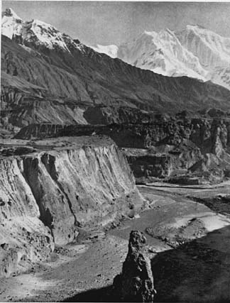
The Northern Areas are a scenic area, which covers thousands of Square Kilometres and has high snow capped mountain, surrounded by green valleys rivers, Glaciers, High meadows and passes. The Northern Area are also frequented by tourists for activities such trekking, climbing and White Water Rafting.

Situated at an elevation of 2,438 meters, Hunza Valley's tourist season is from May to October. The temperature in May is Maximum 27 C and minimum 14 C, in July the max temperature is 30 C. The temperature in October are maximum 10 C and minimum 5 C.

Most of the people of Hunza are Ismaili Muslims, followers of His Highness Prince Karim Aga Khan. The local language is Burushiski. English & Urdu are also understood by many people.

Karimabad the capital of Hunza, offers an impressive view of Rakaposhi 7,788 meters and as well as a view of Ulter Peak 1 and 2, Ladyfinger, Diran Peak and Golden Peak. The snow of Rakaposhi glitters in the moonlight.The fairytale like castle of Baltit, above Karimabad, is a Hunza landmark built 800 years ago. Stilted on massive legs, its wooden look out over the valley.
Mountaineering And Hiking
Hunza is ideal for mountaineering, trekking and hiking, special permits are required for mountaineering.
Today's Hunza
Today Hunza is rapidly developing region, investment in education and industries such as agriculture, building construction, tourism and leisure and health programmes.

Development in Hunza really started to take place after 1978, when the Karakorum highway opened between China & Pakistan, this opened up a major trade route between Islamabad and the Sinking province of China. This resulted in rapid changes in the Northern Area of Pakistan. People came into border business with China. The Aga Khan Network with the collaboration of Government of Pakistan brought fruitful result to life of people of Hunza.

There are self-help schools in every second village in the valley and all children male and female attend schools, apparently 100 percent, this is the reason, why Hunza people are different from not only other valleys in Northern Pakistan but also from rest of the country.

The Tourism started in Pakistan in the 1980,s. The flow of tourism was in Hunza valley, till now, which brought the economic revaluation. Hunza has been a tourist destination from a long time.
People of Hunza
Most of the people of Hunza are Ismaili Muslims, followers of His Highness the Aga Khan. The local language is Brushuski, Urdu and English are also understood by a number of people.
See also

* Hunza Valley (main article on Hunza)
* Northern Areas
* Karakoram Highway
* Karakoram Mountains

References
1. ^ Ben Cahoon, WorldStatesmen.org. Pakistan Princely States. Retrieved on 2007-10-03.
2. ^ Falling rain - Location of Baltit
External links

* Government of Northern Areas
* Government of Pakistan
* PIA guide to Northern Areas

The historical regions of Pakistan are former states, provinces and territories which mainly existed between 1947 and 1975 when the current provinces and territories were finally established.
Burushaski (Urdu: بروشسکی - burū́šaskī) is a language isolate spoken by some 87,000 (as of 2000) Burusho people in the Hunza, Nagar, Yasin, and parts of the Gilgit valleys in
..... Click the link for more information.
Wakhi}}}
Writing system: Arabic, Cyrillic, Latin
Language codes
ISO 639-1: --
ISO 639-2: --
ISO 639-3: wbl

Wakhi is an Iranian language in the subranch of Southeastern Iranian languages (see Pamir languages).
15th century was that century which lasted from 1401 to 1500.
Events

* 1402: Ottoman and Timurid Empires fight at the Battle of Ankara resulting in Timur's capture of Bayezid I.
* 1402: The conquest of the Canary Islands signals the beginning of the Spanish Empire.

September 25 is the 1st day of the year (2nd in leap years) in the Gregorian calendar. There are 0 days remaining.
Events


19th century - 20th century - 21st century
1940s 1950s 1960s - 1970s - 1980s 1990s 2000s
1971 1972 1973 - 1974 - 1975 1976 1977

Year 1974 (MCMLXXIV
Chief Commissioners Province of Baluchistan was a former province of British India located in the northern parts of modern Balochistan province.
History
The province was originally formed over the period 1876-1891 by three treaties between Robert Sandeman and the Khan of
East Bengal was the name used during two periods in the 20th century for a territory that roughly corresponded to the modern state of Bangladesh. Both instances involved a violent partition of Bengal.
Federal Capital Territory (FCT) around Karachi was the original capital territory of Pakistan. The FCT was created in 1948 from the city of Karachi and surrounding areas as the location for Pakistan's capital following independence.
North-West Frontier Province is a former province of Pakistan which was established in 1901 and dissolved in 1955. The province covered an area of 70,709 km² including much of the current North-West Frontier Province province but excluding the former princely states of Amb,
Sind is a former province of Pakistan and British India which existed from 1936 to 1955. The province covered an area of 123,080 km² including much of the current Sindh province but excluding the Federal Capital Territory and the former princely state of Khairpur.

West Punjab was a former province of Pakistan which existed from 1947 to 1955. The province covered an area of 160,622 km² including much of the current Punjab province and the Islamabad Capital Territory but excluding the former princely state of Bahawalpur.
..... Click the link for more information.
East Pakistan (now independent Bangladesh) was a former province of Pakistan which existed between 1955 and 1971. East Pakistan was partitioned from Bengal based on plebiscite in then British India in 1947.

West Pakistan was the popular and sometimes official (1955–1970) name of the western wing of Pakistan until 1971, when the eastern wing (East Pakistan) became independent as Bangladesh.

Amb was a princely state in what is today the North-West Frontier Province of Pakistan. The state ceased to exist in 1969, when it was merged with the province of West Pakistan.

The State of Bahawalpur was a princely state of the Punjab in what is now Pakistan, stretching along the southern bank of the Sutlej and Indus Rivers, with its capital city at Bahawalpur. The state was counted amongst the Rajputana states (now Rajasthan) to the southeast.
..... Click the link for more information.
State of Chitral, or Chitrāl (Urdu: ریاست چترال), was a former princely state of Pakistan and British India which ceased to exist in 1969.

State of Dir was a small former princely state located in the modern North-West Frontier Province in Pakistan. The state ceased to exist in 1969 when it was incorporated into Pakistan.
..... Click the link for more information.
State of Kalat or State of Qalat (Urdu: ریاست قلات) was a princely state located in the centre of the modern province of Balochistan, Pakistan. The state capital was the town of Kalat.
..... Click the link for more information.
State of Khayrpur was a princely state on the Indus River in what is now Pakistan, with its capital city at Khayrpur. Together with Bahawalpur to the north-east, the state was counted amongst the Punjab states rather than the neighbouring Rajputana states (now Rajasthan) to the
..... Click the link for more information.
State of Kharan was an autonomous princely state of both British India and Pakistan, located in the southwest of modern Pakistan.
History
The state of Kharan was established in about 1697 CE as a vassal state of Kalat, a status which remained until 1940.

State of Las Bela was princely state of Pakistan and British India which existed until 1955. The state occupied an area of 18,254 km² in the extreme southeast of the Balochistan province with an extensive coastline on the Arabian Sea to the south.

The State of Makran was an autonomous princely state of both British India and Pakistan, which ceased to exist in 1955.
..... Click the link for more information.
The State of Nagar(Urdu.ریاست نگر) is a former princely state in the northernmost part of the Northern Areas of Pakistan, which existed until 1974.
The State of Phulra was a minor princely state of both Pakistan and British India, located in the modern North-West Frontier Province. It was situated east of the nearby princely State of Amb.

State of Swat (Urdu: ریاست سوات) was a princely state which existed in the north of the modern North-West Frontier Province of Pakistan until it was dissolved in 1969.

Baluchistan States Union existed between 3rd October 1952 and 14th October 1955 in southwest Pakistan. It was formed by the states of Kalat, Kharan, Las Bela and Makran with the capital at the town of Kalat.

Gilgit Agency was the name of most of the area of northern Kashmir which formed a de facto dependency of Pakistan from 1947 to 1970, which was then merged into Northern Areas.

The Trans-Karakoram Tract is an area of nearly 5,800 km² that India claims, was transferred by a border agreement from the Pakistani-administered Northern Areas to China in 1963 with the proviso that the settlement was subject to the final solution of the Kashmir dispute.

The Divisions of Pakistan were previously the third tier of government in Pakistan until they were abolished in 2000. The four provinces of Pakistan had been subdivided into administrative "Divisions", which were further subdivided into districts and tehsils.


This article is copied from an article on Wikipedia® - the free encyclopedia created and edited by online user community. The text was not checked or edited by anyone on our staff. Although the vast majority of the Wikipedia® encyclopedia articles provide accurate and timely information please do not assume the accuracy of any particular article. This article is distributed under the terms of GNU

Personalities of hunza

Nazir Sabir

Nazir SabirNazir Sabir is a Pakistani mountaineer. He was born in Ramanji a small hamlet in Chiporsun, upper Hunza known as Gojal. He is the only Pakistani to have climbed Mount Everest and four of the five 8000m peaks in Pakistan, including the world’s second highest peak K2 in 1981, Gasherbrum II and Broad Peak in 1982, Gahserbrum 1( Hidden Peak 8068m ) in 1992 and he became the first climber from Pakistan to have summitted Everest on May 17, 2000 with Mountain Madness Everest Expedition led by Christine Boskoff of the USA.

Climbing career

Nazir started off his climbing career with a Japanese expedition to the 7284m Passu peak in Hunza in 1974. In 1975 he was part of a German Expedition as a trainee that attempted Nanga Parbat (8125m) and only went to 6700m up the S W Ridge. On July 17 1976 he made the first ascent of 6660m virgin Paiyu followed by Col. Manzoor Hussain and Major Bashir with the first Alpine Club Expedition.

In 1977 Nazir Sabir joined the largest Japan/Pakistan joint expedition to K2, attempting the traditional South East Abruzzi ridge. It was a huge expedition, using bottled Oxygen; this team had an army of 1500 porters and 52 members. However Nazir Sabir’s first assault team including four Japanese had to turn back due to snow storms from 8280m. Another attempt with the same team had to be abandoned again from 8150m when they had to come down searching for two missing colleagues who were found alive below C4. However they put six members of the team on the summit making the second ascent of K2.

Till then only two mountaineers of the 1954 successful Italian expedition had stepped on the K2 Summit. Nazir Sabir got the chance to climb K2 in 1981 by accompanying a Japanese Waseda University Expedition to K2 attempting the West and South West ridge rather than the usual Abruzzi ridge. The Duke of Abruzzi had, in 1909, surveyed K2 from all its sides. He felt that K2 could only be assailed from the South West ridge, which was to be named Abruzzi Ridge. The route to the Wes/North West Ridges of K2 is via Savoia Glacier. This is north of Godwin Austen Glacier and the traditional K2 Base Camp. It involves a difficult grade, ice and rock climb at higher elevations with winds at 100+ km/h. In 1978 the famous British climber Chris Bonnington made his first attempt on this route. Nick Estcourt, part of this team, was swept to his death by a slab avalanche above their Camp I.

Nazir, followed by Eiho Otani, reached the K2 summit on 7 August 1981. Nazir created history by successfully climbing K2's W/South West Ridge for the first time. He was the second Pakistani to stand on K2 summit and first via this route. A documentary film of the climb, "50 Day Struggle" shown all over Japan, made Nazir Sabir a house hold name in Japan. In due course Nazir had also picked up Japanese language and could speak it fluently.

Nazir Sabir in 1982, along with Sher Khan climbed with the famous Italian mountaineer Reinhold Messner and scaled Broad Peak (8047 m) and Gasherbrum II (8035 m) in one attempt. Both Gasherbrum II and Broad Peak were done in Alpine style in a period of just one week the fastest ascent of two 8000m peaks at that time!

Expeditions to the Killer Nanga Parbat

He made three attempts on Nanga Parbat. His first was in October 1981, two months after his great success on K2 when he joined his friends from the Sangaku Doshikai Club Tokyo lead by M. Omiya. They followed the First serious attempt route of A F Mummery. Nanga Parbat claimed its first of many victims when Mummery and two Gorkha Sherpas were killed by an avalanche. Nazir and the Japanese abandoned due to the heavy crevasses on lower part of the Diamir Glacier and avalanches after heavy snow fall that autumn.

Then he challenged the SS West side also known as Schell Route of Nanga on the Rupal flank in 1983 with Tohokeiryo Kai Club friends. As he was leading a pitch up a chest deep snow face around 7200m he fell 400 meters on top an avalanche along with seven Japanese colleagues nearly to the bottom of the face but barely survived as he stopped only 20m from the edge. One of the team members Shimura fell some 2000m down the face never to be found again. Nazir ended up with bruises all over the body and a sprained ankle while the team doctor Dr. Arai and Wakutsu had one broken arm each and the expedition leader Osamu Kunii had four ribs broken. Kunii also had a deep cut across his belly by the friction of the rope showing his intestines. The mountain took its toll and the expedition had to be abandoned.

Nazir lured his old time friend and one of the most accomplished Himalayan Climbers Doug Scott and his team to go on the same route of Nanga Parbat. Doug Scott , his son Michael, Aliester and Nazir free climbed and dashed to 7150m in a two day push from Base Camp at 3600. Doug got ill at the second bivouac around the same spot where they were swept with an avalanche in 1983 and had to abandon the Killer Mountain yet again.

Death of Brother

In July 1980, Nazir Sabir lost his elder brother, who servesd in the Pakistan Army SSG(Marines). He along with Shaukat Nazir Hamdani and Rasheed were buried under an ice avalanche while attempting Diran 7527m on this Army SSG Expedition while waiting out a bad weather spell in camp-3 thus ending the hopes of Nazir and his brother to climb Broad Peak the following year and many mountains together. The Expedition was lead by the famous Brig TM.

Everest Expeditions

Nazir Sabir’s attempt on the Everest leading the first Pakistan Expedition of ten plus a film team in 1997 resulted in failure due to very strong winds blowing across the summit ridge from 8630m on his first attempt and again from above 8500m on his two other summit bids he had to return with his five colleagues due to strong blizzards.

But on 17 May 2000, climbing in the company of his Nepalese Sherpa team and a Canadian on a full moon night to avoid high winds he reached Everest summit at 0730 hours becoming the first from Pakistan to get to the roof of the world. He first paid tribute to his many dead friends on the higher ground of Everest including Scott Fischer, Rob Hall, Ube Akira, Kobayashi, Yasuo Kato, Futagami and many more who gave their lives in love of these eternal higher heavens.

While waiting for Ben Webster of Canada and two other Sherpas he went on enjoying the most splendid moments of his life with his two Sherpa colleagues taking video shots of Ben and others climbing the last part of the summit ridge and the magical surroundings against the backdrop of the much blessed early morning sun approaching from behind 8462m Makalu, 5th highest mountain in the world.

He spoke to the base camp and sent the message of humbleness and happiness back home and to his closest friends who were watching his progress and counting steps up the last part of the mountain as he climbed through the clear night winds. He received hundreds of messages from across the country and the globe including that of Benazir Bhutto who was second to send in her congratulations from London where she lived at the time.

Political career

As a reward for years of services rendered to the people of Hunza, Nazir was elected as their representative to the Northern Area Legislative Council in the October 1994 elections and appointed Advisor on Education and Tourism to the government. Campaigning for the Hunza seat in the 1994 elections for the Northern Area Assembly, for a five year term, he defeated his opponent from the traditional Mir of Hunza family with a wide margin. He was appointed as Advisor on Education and Tourism for the Northern Area. He has remained a member of the Northern Areas Legislative Council and Education Advisor of the administration of the Northern Areas of Pakistan.

Honours and as environmentalist

For his outstanding achievements he earned the prestigious President’s Award for Pride-of-Performance [1] in 1982 and was honored with The Sitara-i-Imtiaz (Star of Excellence) in 2001 for his outstanding performance in mountaineering sports. His latest honour is the Presidentship of the Alpine Club of Pakistan, to which he was elected unanimously on October 10, 2004 and again for another term in 2007. Presently he heads the Alpine Club of Pakistan, which trains and prepares men and women from all around Pakistan to become climbers. Nazir Sabir is currently working as an environmentalist on the conservation of wildlife in his native Hunza Valley and across Nothern Pakistan including the Baltoro Glacier region. He is involved on the conservation 0f the 5000 years old world heritage of Juniper forests in Ziarat Balochistan in collaboration with the Chiltan Adventure. He has also been raising voice on environmental matters in the Siachen Glacier region and across the Karaakoram belt, opposing the Polo Tournaments at Shandur Pass and the Babusar Pass that is polluting the serene environment and is against the animal rights.

Business career

Nazir Sabir is operating an an adventure travel oufit which he is running under the name of "Nazir Sabir Expeditions" and is known for reliable adventure business. He has been actively involved in promoting Pakistan as a unique tourism destination " The Best Kept Secret " in South Asia and has traveled extensively around the world lecturing on the country’s cultural, historical and adventure potential.

International events

On the invitation of UIAA/IUCN (www.uiaa.ch/iucn/) he participated in the Indo Pakistan and UK Peace Climb in the Swiss Alps in 2002, organized to focus attention on environmental degradation in the Siachen Glacier area due to the ongoing conflict between India and Pakistan.

He also attended the Int’l Congress on “Future of Mountain Sports” (www.mountainfuture.at) at Innsbruck (Austria) in 2002, centennial celebrations of American Alpine Club Salt Lake City in 2002, Sagarmatha Golden Jubilee celebrations in Kathmandu Nepal in 2003.

For over two decades he has been representing Pakistan and delivered lectures on the tourism potential of Pakistan at international forums and Alpine Clubs in Japan,USA, Australia, UK, Germany, Austria, Canada, Nepal, South Korea, Hong Kong, Tajikistan, Poland, Slovakia, Malaysia France and Italy. He was invited to be a jury member at the Banff Mountain Film Festival Canada in 1996, Vancouver International Mountain Film Festival (VIMFF) in 2002, Bratislava Mountain Film Festival in 2002, and was invited as chief guest at the Kathmandu International Mountain Film Festival in 2006. He also participated at the Trento Mountain Film Festival in 2003.

As a photojournalist and naturalist Nazir Sabir has in his archives a collection of over 5000 slides of mountains and the culture surrounding them and he goes around doing promotional slide talks at universities and different platforms in Pakistan and around the globe.